As 2024 progresses, the Mid-Atlantic and Northeast regions brace for a potential end to their snow drought, thanks to an impending winter storm. This storm, forecasted to move across the area this weekend, doesn't seem to promise a major snow event for cities like D.C., Baltimore, or Philadelphia. However, areas from New York to Boston could see a more significant snowfall, potentially enough to require plowing.
The storm's origins lie in the energy moving from the Pacific Northwest, which will gather moisture from the Southeast. This mix is expected to bring snow, sleet, and rain across the Mid-Atlantic on Saturday. For cities such as Washington, Baltimore, and Philadelphia, computer models suggest a mix of precipitation with temperatures in the mid-30s, but as the storm is still a few days out, these predictions could shift. By Sunday, the storm may disrupt travel from eastern Pennsylvania northeastward to the Hudson Valley, possibly causing airport delays due to mixed precipitation and low clouds.
Hartford and Boston stand a better chance of receiving 3 to 6 inches of snow or more from this storm. The low-pressure area may intensify far enough south of these regions to prevent a changeover to rain on Sunday. However, earlier models predicted a more intense storm. Various factors, including the jet stream position and upper-level winds over Canada, are likely to keep the storm system relatively weak and fast-moving until it's off the coast of southern New England.
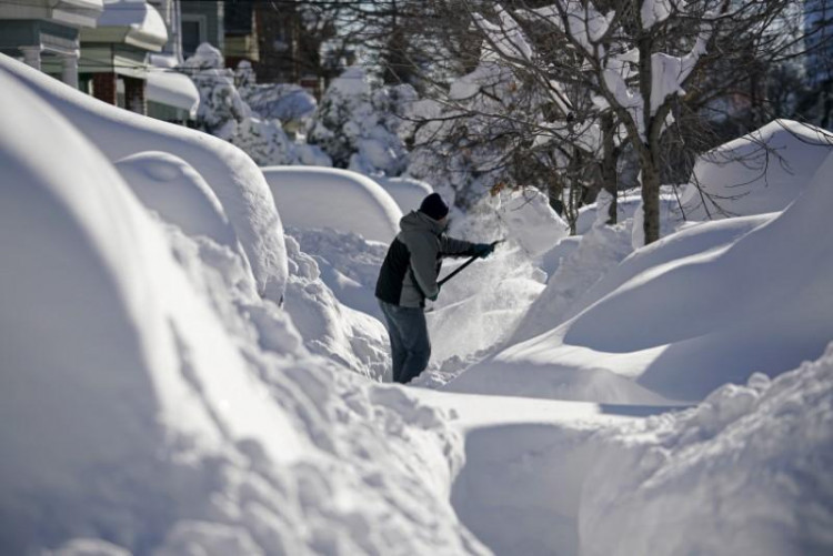
In a typical winter, such a storm might not be noteworthy news, but the target region has not seen more than an inch or two of snow for up to two years. For instance, Washington's last winter brought a mere 0.4 inches of snow to Reagan National Airport, significantly below the average. Similarly, New York City's Central Park hasn't seen an inch of snow since February 2022, and Boston's most considerable snowfall last winter was only 3.5 inches.
As January unfolds with a colder and more active weather pattern, the potential storm system could impact the mid-Atlantic, Northeast, and New England from Saturday to Monday. The I-95 corridor cities, experiencing their longest snowless periods, are particularly anticipating their first significant winter storm in two years. However, exact snowfall totals remain uncertain, and the storm's track will determine the precipitation type and the most affected locations.
While the East Coast prepares for this potential wintry weather, the West is not left out. A series of Pacific storms is expected to bring rain, mountain snow, and battering waves to the region, continuing the stormy start to 2024 for much of the country. High surf advisories and winter alerts are in effect across the West Coast and Sierra.
As the weekend draws near, residents and authorities in the affected regions remain vigilant, preparing for a storm that may prove more significant for breaking snowless streaks than for producing large amounts of wintry precipitation.


