A dangerous combination of dry and windy weather is expected to create an extreme risk of wildfires across parts of Texas and Oklahoma on Wednesday, just weeks after the region experienced its largest wildfire on record. The National Weather Service has warned of a possible "wildfire outbreak," using unusually serious language to convey the severity of the situation.
NOAA's Storm Prediction Center has highlighted areas of the Texas and Oklahoma panhandles, as well as parts of West Texas and eastern New Mexico, as being at an extreme risk - a level rarely issued by the agency. "This is the first time that this extreme or a Level 3 out of 3 risk has been issued so far this year," said FOX Weather Meteorologist Kendall Smith. "That's why it's important and why you have to make note of it."
The critical threat area stretches from Kansas into northern Mexico, with communities such as Amarillo, Texas, and Woodward, Oklahoma, in the extreme threat zone. According to the FOX Forecast Center, a storm system exiting the Rockies into the Plains will help enhance the wildfire risks, with wind gusts expected to reach well over 30 mph and humidity values that could plunge below 10%.
The combination of conducive weather conditions, an intensifying drought, and dead vegetation has led to the increased fire risk. The Texas A&M Forest Service said it's a unique set of circumstances that likely won't change anytime soon. "Fuels have dried even further since the wildfire outbreak at the end of February," wrote the Weather Service's Storm Prediction Center in its fire weather outlook Tuesday afternoon.
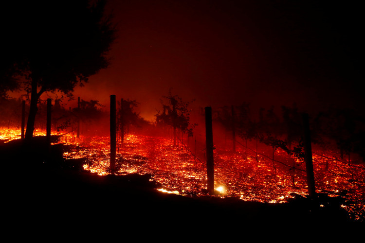
Barely two and a half weeks ago, the Smokehouse Creek Fire, believed to have been started by improperly working utility equipment, torched approximately 1.06 million acres in Texas and Oklahoma, making it the largest wildfire in Texas history. The blaze, which is still only 89% contained, is squarely in the center of Wednesday's risk zone, raising concerns about rapid spread once again for established wildfires, as well as the sparking and kindling of new infernos.
Exacerbating matters is the "curing," or dying, of early-sprouting grasses that were killed by a cold snap and snows in the Texas Panhandle two weeks ago, leaving even more grassy detritus on the ground to burn. Actual air temperatures will be in the 70s - at least 10 to 15 degrees above average - which will speed up evaporation, sapping the landscape of moisture.
Beyond Wednesday, forecast models show a flow out of the south and west will continue throughout the week, but higher humidity values could reduce how fast wildfires grow. However, there remains no significant precipitation in the extended forecast, with many of the alerted areas seeing less than a quarter-inch of precipitation over the next seven days.
The Smokehouse Creek Fire killed two people and at least 3,600 cattle in the Texas Panhandle, and its full toll is just beginning to come into focus. Xcel Energy, a utility in Texas, acknowledged that its power equipment probably ignited the blaze, which was fanned by powerful winds. In California, PG&E began the Public Safety Power Shutoff program in 2018 to cut down on the risks of electrical equipment starting new wildfires. However, neither the State of Texas nor Xcel Energy have said they plan to de-energize lines ahead of the latest fire threat.
As the region braces for another potentially devastating wildfire outbreak, residents are urged to stay vigilant and heed all warnings from local authorities. The National Weather Service and other agencies will continue to monitor the situation closely and provide updates as necessary.


