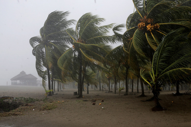
As Southern California braces for the impact of an incoming atmospheric river, meteorologists are issuing urgent warnings about the potential for life-threatening flooding in the region. The second storm, more potent than its predecessor, is forecasted to unleash its fury from Sunday into the next week, with the National Weather Service in Los Angeles highlighting the escalating risks of prolonged heavy rain starting late Saturday night.
This atmospheric phenomenon, characterized by a long, narrow band of moisture-laden air, is expected to stall over the state, dumping a deluge that could exceed a month's worth of rain in a matter of days. Regions from Santa Barbara to the greater Los Angeles area are predicted to be the hardest hit, with the weather service forecasting widespread rainfall totals ranging from 3 to 6 inches from late Saturday to Wednesday. The anticipated downpour comes on the heels of a storm that already set rainfall records in several locales and necessitated numerous water rescues.
The impending storm's potency is attributed to its atmospheric river origins-a conveyor belt of saturated air that extends thousands of miles and discharges its contents like a fire hose upon making landfall. Meteorologists are particularly concerned about the rapid onset of flash flooding, especially in areas where the soil is already saturated from recent rains. The weather service has placed a Level 3 of 4 risk of excessive rainfall for coastal sections of Central and Southern California, including Santa Barbara, with the threat extending to Los Angeles by Monday.
The forecasted deluge poses a myriad of hazards, including urban flooding, mud and rock slides, and river overflows. The mountainous and foothill regions of Southern California are bracing for up to a foot of rain, exacerbating the risk of debris flows in these already vulnerable areas. Travel through the central part of the state is anticipated to become perilous as heavy snowfall is expected in the Sierra Nevada, with accumulations reaching up to 4 feet.
Meteorologist Mike Wofford, with over three decades of experience at the weather service's LA office, described the forecasted rainfall totals as "almost unprecedented." The agency is particularly concerned about the mountains of Santa Barbara County and western Ventura County, where rainfall could surpass 15 inches, leading to significant flooding and other water-related challenges.
The looming atmospheric river is part of a broader shift towards a more typical El Niño pattern, which influences weather globally by altering the jet stream and directing storms towards California. These storms can tap into an even more potent moisture supply from the tropics, known as atmospheric rivers, amplifying their impact.
As the region reels from the effects of the first atmospheric river and prepares for the next, residents are urged to take precautions, including potential evacuations and using sandbags to protect vulnerable areas. The stark warnings from meteorologists underscore the gravity of the situation, with comparisons being drawn to historic storms that have wrought devastation in similar circumstances. The community and emergency services are on high alert, gearing up for a challenging week ahead as they contend with the forces of nature unleashed by this formidable atmospheric river.


