Severe weather swept through the Chicago area on Tuesday, prompting multiple tornado warnings and severe thunderstorm alerts across northern Illinois, including parts of Cook County and the city of Chicago itself. The National Weather Service issued a tornado watch effective through 10 p.m., covering northeastern Illinois and northwest Indiana, with the entire NBC 5 viewing area on high alert.
Specific areas like southeastern McHenry County, southern Lake County, northwestern DuPage County, and northwestern Cook County were under active tornado warnings slated to last until at least 7:45 p.m. Meanwhile, nearly all of northeastern Illinois was placed under severe thunderstorm warnings until 8:15 p.m., with meteorologists warning of half-dollar-size hail and wind gusts surpassing 70 miles per hour.
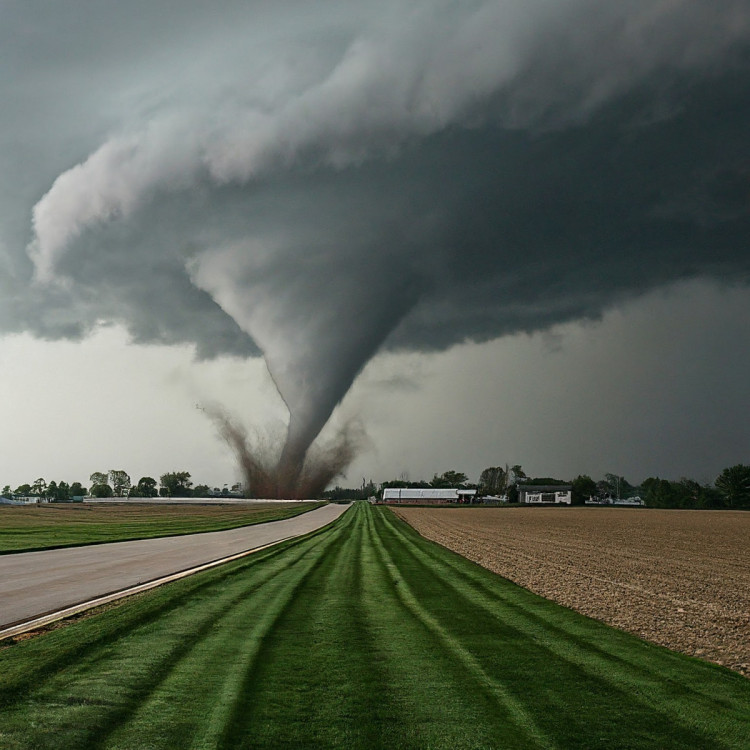
The severe weather, characterized by intense thunderstorms, was anticipated to hit the region in the evening, propelled by a swiftly moving cold front. Forecasts included the potential for tornadoes, some potentially significant, damaging hail, and strong gusty winds. The Storm Prediction Center escalated the area's risk level to "enhanced," indicating that gusts could reach up to 60 miles per hour, and hail could grow to two inches in diameter, alongside the tornado threat.
Officials pinpointed the main tornado threat to areas along and south of Interstate 80, with the National Weather Service emphasizing the risk of heavy downpours and gusty winds across the entire region. These conditions posed risks of damage to tree limbs, power lines, and unsecured outdoor objects.
The hail threat was particularly acute within the "enhanced" risk zone, where hailstones could measure two inches or more in diameter. However, the severe weather was expected to clear the area by late evening, leading to a dramatic drop in temperatures into the 30s overnight and further down into the 20s by Wednesday morning.
In the aftermath, the chance of accumulating snow lingered, especially west of Chicago, where the departing low-pressure system could interact with cooler temperatures and ample moisture to produce significant snowfall.
Cook County and Chicago experienced the severe weather firsthand, with the Office of Emergency Management and Communications issuing warnings and the National Weather Service forecasting quarter-sized hail and wind gusts up to 70 mph. Social media reports of tornado sightings circulated, though official confirmations were pending.
The severe conditions caused disruptions, including about 8,500 power outages predominantly in the Northwest and western suburbs, as reported by ComEd around 8:40 p.m. Air travel was also affected, with a ground stop implemented at O'Hare International Airport and traffic management measures in place at Midway Airport according to the Federal Aviation Administration.
Metra, the local commuter rail system, warned of "extensive delays" on the Union Pacific Northwest lines due to the tornado warnings, particularly affecting trains near Barrington.
Earlier in the day, temperatures in the area soared to near-record highs, with O'Hare International Airport recording 74 degrees just after 3 p.m., narrowly missing the record by one degree. The daily record for February 27th was set in 1976, when temperatures reached 75 degrees, marking it as the warmest day in February on record according to meteorologist David King.