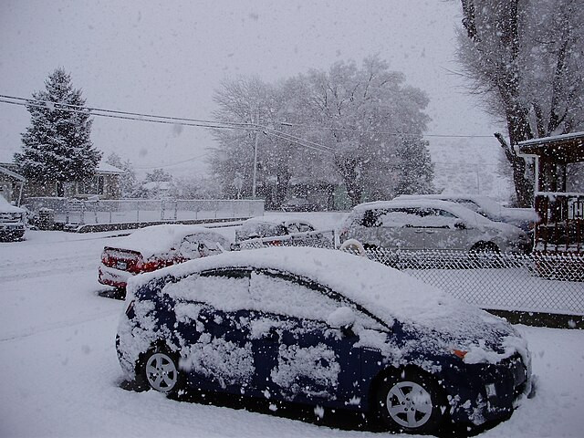
Two powerful winter storms are set to bring heavy snow, strong winds, severe thunderstorms, and flash flooding to large swaths of the northern United States starting Friday and continuing into next week. The first storm has already caused hundreds of crashes across the Upper Midwest as snow blanketed the region, while the second storm is expected to bring even higher accumulations and stronger winds.
Winter alerts have been issued for 32 million people from Friday through Saturday, spanning from the northern Rocky Mountains and the Upper Midwest through the central Great Lakes region and into New England. The first storm moved quickly across eastern Minnesota, Wisconsin, and Michigan on Friday, with snow accumulations ranging from 2 to 7 inches overnight. The storm is expected to bring light to moderate snow to the interior Northeast and New England on Saturday, with accumulations reaching as high as 12 to 18 inches in northern New England.
"The system is so strong in the mid-levels of the atmosphere that we're getting thundersnow reported across the area," said FOX Weather Winter Storm Specialist Tom Niziol. "The Storm Prediction Center just put out a discussion referring to the fact that we've got a lot of deep convection going on with that thundersnow. That's why you're going to see these snowfall rates."
A Winter Storm Watch has been issued for Central MN and NW WI as heavy snow and strong winds are expected to move in Sunday. Our weekend crew will be working hard to keep you updated as details become more clear with hi-res guidance coming in today and tomorrow. #mnwx #wiwx pic.twitter.com/RRp8B0RKJ1 — NWS Twin Cities (@NWSTwinCities) March 22, 2024
The second storm, set to kick off on Sunday, is expected to bring even higher snow accumulations and stronger winds to the Upper Midwest than the first storm. However, it will not bring accumulating snow to New England. The storm will impact North Dakota, South Dakota, Minnesota, and northern Wisconsin on Sunday, and will slow down and strengthen over the Upper Midwest on Monday, bringing continuous snow and strong wind gusts to the Dakotas and Minnesota until at least midday Tuesday.
Snow accumulations during the second storm could be as high as 12 to 18 inches in parts of Minnesota, including the Minneapolis metro area and Duluth. The region spanning from the Dakotas into western Minnesota, known as "blizzard alley," may live up to its name early next week, with winds forecast to be as high as 35 to 40 mph, potentially bringing blizzard conditions.
In addition to the heavy snow and strong winds, the storms also pose a risk of flash flooding for 53 million people in South Florida and southern New England. Cities in the risk zone include Miami, Washington, D.C., New York City, and Boston. On Friday, the flood risk is highest for South Florida, where 6 to 7 inches of rain could fall, along with the potential for severe thunderstorms capable of producing high winds and isolated tornadoes, especially in the Florida Keys. The flood risk will shift to southern New England on Saturday, with a widespread 2 to 4 inches of rain expected, including for the Interstate 95 corridor.
The FOX Forecast Center noted that the ground has been bare leading up to this active stretch, but any fresh snow received Friday will make it easier for snow to accumulate during the next event - the even stronger winter storm forecast for the region early next week.
As the storms continue to develop and move across the country, residents in affected areas are urged to stay informed about local weather conditions, heed any warnings issued by authorities, and take necessary precautions to ensure their safety. With hundreds of crashes already reported in the Upper Midwest and the potential for blizzard conditions, flash flooding, and severe weather in the coming days, these winter storms serve as a powerful reminder of the importance of staying prepared and vigilant during extreme weather events.


