A powerful and deadly spring storm continues to batter the central United States, bringing near-blizzard conditions, heavy snow, and strong winds to a vast swath of the region from the Plains through northern Minnesota. The storm, which has already claimed at least two lives in Minnesota, is expected to significantly impact the area through Tuesday, with winter weather alerts stretching for more than 1,000 miles from Texas to Michigan.
The Minnesota State Patrol reported hundreds of crashes, spinouts, and jackknifed tractor-trailers on Sunday due to the treacherous winter weather conditions. One woman was killed in a crash south of Minneapolis on Interstate 35 East in Burnsville, while details about the second storm-related death were not immediately available.
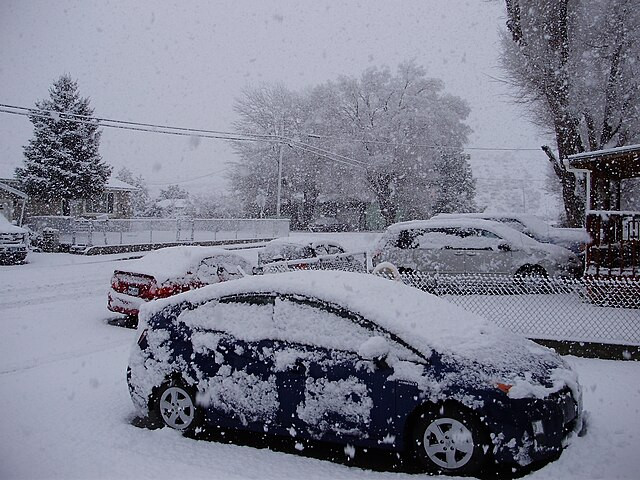
Minneapolis experienced a record-breaking snowfall on Sunday, with the Twin Cities receiving 8.2 inches of snow, surpassing the previous daily record of 6.2 inches set in 1996, as reported by AP. It was also the snowiest day in Minneapolis since January 2023 and the snowiest March day since 2007.
Schools across the region, from the Plains to the Upper Midwest, were closed due to the storm, and the Nebraska Department of Transportation announced the closure of a nearly 150-mile-long stretch of Interstate 80 from Kearney to Ogallala due to the hazardous travel conditions, including blowing and drifting snow.
The National Weather Service office in Hastings, Nebraska, warned people to stay off the roads, stating in its Blizzard Warning, "Travel should be restricted to emergencies only. If you must travel, have a winter survival kit with you."
Video footage captured at Denver International Airport showed what appeared to be graupel, or "snow pellets," falling from the sky as the storm impacted the area. Another video showcased the treacherous driving conditions in Timnath, Colorado, as the powerful storm dumped heavy snow across the region.
According to the FOX Forecast Center, the storm will continue to affect the northern and central Plains and the Upper Midwest through Tuesday, with periods of snow and strong winds persisting from the central Plains to northern Minnesota, along with some sleet and freezing rain in parts of the upper Mississippi Valley.
While Minneapolis experienced record-breaking snowfall on Sunday, the snow is expected to be replaced by rain on Monday before switching back to a mix of freezing rain, sleet, and snow as the storm comes to an end on Tuesday. However, for those on the colder side of the storm, snow will continue to accumulate.
Bands of heavy snow with snowfall rates of 1-2 inches per hour are anticipated from central Nebraska and eastern South Dakota to northern Minnesota. Additional snow totals between 5 and 12 inches are forecast from central Nebraska to northeastern Minnesota, with more than a foot of additional snow possible across northern Minnesota and the Arrowhead, where Blizzard Warnings remain in effect.
Blizzard Warnings continue in parts of Colorado, Kansas, Nebraska, South Dakota, and Minnesota through Tuesday, while Winter Weather Advisories stretch from the Texas Panhandle to Michigan's Upper Peninsula. The bulk of Winter Storm Warnings are in effect from the Dakotas to northern Wisconsin.


