A powerful winter storm is poised to sweep across the eastern two-thirds of the United States this weekend, delivering heavy snow, significant ice, and dangerously low temperatures to millions. The National Weather Service (NWS) has issued widespread winter weather alerts, warning of severe travel disruptions, power outages, and life-threatening cold as the storm progresses.
The system, which began forming off the West Coast on Friday, initially brought rain to the Pacific Northwest and snow to the Cascade Mountains. By late Saturday, it is expected to intensify over the Central Plains before tracking eastward into the Ohio Valley, Mid-Atlantic, and Northeast through early next week.
Forecasters predict widespread heavy snow across the Central Plains, particularly along and north of Interstate 70. Areas in central Kansas to Indiana could see accumulations of at least eight inches, marking the heaviest snowfall in a decade for some locations. St. Louis, Indianapolis, and Cincinnati are among the cities likely to experience snow totals ranging from six to 12 inches, alongside ice accumulations of up to half an inch.
Wind gusts exceeding 35 mph, coupled with heavy snowfall rates, could create blizzard conditions in parts of Kansas and neighboring regions by Sunday morning. The NWS has cautioned that whiteout conditions may make driving "dangerous to impossible" and significantly increase the risk of travelers becoming stranded.
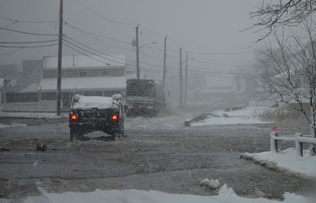
In addition to snow, freezing rain is expected to wreak havoc from eastern Kansas through Missouri, Illinois, and into the Ohio Valley. This icy mix could accumulate to more than a quarter-inch in some areas, raising concerns about downed tree limbs, power outages, and treacherous road conditions. "It's going to be a mess, a potential disaster," said private meteorologist Ryan Maue.
As the storm moves eastward, severe thunderstorms are anticipated across the South, impacting regions from southeast Texas to Mississippi and southern Tennessee on Sunday. These storms could exacerbate hazardous conditions in areas already affected by sleet and freezing rain.
On Monday, the storm will shift into the Mid-Atlantic and Northeast, with cities such as Pittsburgh, Richmond, Washington D.C., Baltimore, and Philadelphia expected to see heavy snow and ice. Areas south of New York City may experience the highest snowfall totals, further complicating travel and daily activities.
Following the storm, Arctic air will plunge into the U.S., bringing temperatures 12 to 25 degrees Fahrenheit below average for much of next week. The polar vortex, a mass of ultra-cold air typically confined to the Arctic, is stretching southward, intensifying the cold snap. "This could lead to the coldest January for the U.S. since 2011," said Dan DePodwin, AccuWeather's Director of Forecast Operations.
The most dramatic temperature drops are forecasted for the Ohio Valley, but the chill will extend as far south as the Gulf Coast and Florida, where a hard freeze is expected. "The wind chills are going to be brutal," noted Jennifer Francis, a climate scientist at the Woodwell Climate Research Institute.
Experts link the severity of the storm to the warming Arctic, a phenomenon that has been shown to increase the likelihood of polar vortex disruptions. Judah Cohen, seasonal forecast director at Atmospheric and Environmental Research, said studies indicate that a warming Arctic contributes to more frequent and intense cold snaps in the U.S., Europe, and Asia.
The storm's impacts are already being felt, with light snow reported across portions of the Northeast on Friday. As the system strengthens, more than 45 million people are under winter alerts, spanning from Kansas to Maryland. The NWS has urged residents in affected areas to prepare for hazardous conditions, including stocking emergency supplies and avoiding unnecessary travel.


