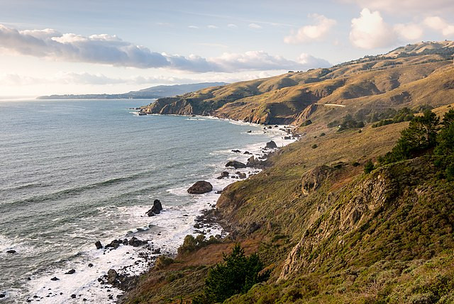
A massive earthquake along the Cascadia Subduction Zone could instantly sink swaths of the U.S. Pacific Northwest coastline by more than six feet, drastically expanding floodplains and posing long-term risks to infrastructure, communities, and ecosystems from Northern California to Washington, a new scientific study warns.
Published Monday in the Proceedings of the National Academy of Sciences, the study examines the potentially devastating effects of a magnitude 8.0 or greater earthquake along the 600-mile-long fault line that lies offshore from British Columbia to Northern California. Researchers found such a quake could permanently alter coastal geography and flood risk within minutes.
Lead author Tina Dura, assistant professor of geosciences at Virginia Tech, stated: "The expansion of the coastal floodplain following a Cascadia subduction zone earthquake has not been previously quantified, and the impacts to land use could significantly increase the timeline to recovery."
According to the analysis, coastal land could subside more than six feet instantly. Combined with sea-level rise, this would increase the flood-prone area by as much as 115 square miles-more than twice the size of San Francisco. The number of residents at risk of flooding could jump from 8,000 to over 22,000, while the number of at-risk structures could rise from 13,000 to 36,000.
If such an event were to occur in the year 2100, the effects would be even more severe. Factoring in projected sea-level rise, researchers estimate that an additional 17,710 residents, 29,060 structures, and 1,000 miles of road could be exposed to flooding-a 218% increase over current levels.
The study also warns that vital infrastructure-including wastewater treatment plants, airports, and fire stations-would face major vulnerability, particularly in densely populated areas such as southern Washington, northern Oregon, and coastal Northern California.
The last known megathrust quake along the Cascadia Subduction Zone occurred in 1700. Geological and oral records, including those from the Huu-ay-aht First Nation on Vancouver Island, describe forested lands and villages vanishing into the sea. Japanese historical accounts recorded a tsunami, known as an "orphan wave," arriving hours later, helping scientists date the event precisely.
Modern projections estimate a 15% chance of a magnitude 8.0 or greater earthquake along the entire Cascadia zone in the next 50 years. For the southern portion alone, the probability climbs to between 37% and 42%, according to U.S. Geological Survey data.
"Preparing for these compound hazards can minimize long-term damage, ensure resilient communities, and protect critical coastal ecosystems from permanent degradation," the study's authors wrote.