Tropical Cyclone Gati, the strongest cyclone measured in the northern Indian Ocean, has made landfall in eastern Africa.
Experts estimate Gati might drop more than two years' rain in the region over the next two days.
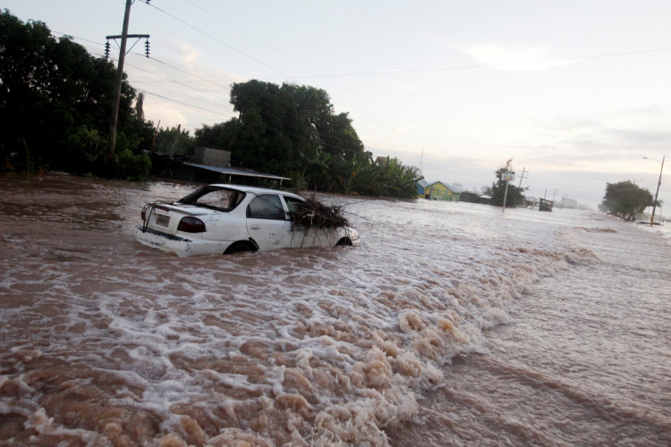
Gati made landfall in Somalia on Sunday - bringing with it rains and sustained winds of up to 105 miles an hour. According to the National Oceanic and Atmospheric Administration, Gati is the first recorded hurricane-strength cyclone to hit the country.
"Gati is the strongest tropical cyclone that has been recorded in this region of the globe - further south than any category 3-equivalent cyclone in the North Indian Ocean," the administration said.
Before making landfall sustained winds had reached a maximum of 115 miles an hour - the strongest recorded in the region. Accuweather said that the winds were likely a result of the cyclone's relatively small size and the warm waters in the area. In comparison, the strongest storm to hit Somalia was in 2018. The cyclone brought winds of 60 miles an hour.
Meteorologists said the formation of such a storm in the area may be related to the continually warming ocean temperatures caused by climate change. Climate journalist Eric Holthaus said in a report that the formation of Gati may be part of a worldwide pattern of stronger storms as humans continue to disrupt the planet's natural systems.
Accuweather forecasts the cyclone will likely move north - hitting western Oman, Yemen and Socotra through Tuesday. The weather forecasting service provider warned residents affected areas could be hit with abnormally heavy rain and flash floods.
Heavy rainfall in Somalia is relatively rare - with the country getting about 4 inches each year, administration data shows. Gati is expected to drop about 8 inches of rain, or two years' worth, in just two days.
The United Nations has issued an alert to all vessels in shipping lanes linking the Gulf states to Somalia. They have been waved away from the area until the cyclone dissipates.