Strong winds are blowing over Hong Kong on Wednesday, especially after Tropical Storm Barijat moved closer to the city. However, the attention was shifted to a larger threat - Super Typhoon Mangkhut. The latter is reportedly moving towards the South China Sea.
According to the South China Morning Post, typhoon signal no. 3 Barijat was up for a few hours on Wednesday afternoon when the Hong Kong Observatory announced its chances of upgrading to a no. 8 were not high.
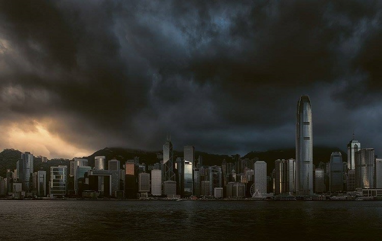
At around 9 pm, it said Barijat was already about 180km (111 miles) to the south-southwest of the city. There were also strong winds affecting the Pearl River Estuary; hence, the agency announced that signal 3 would be in effect for some time, though it would weaken come Thursday.
The storm as mentioned above was believed to be moving west, with wind speeds of about 41km/h to 62km/h and gusts exceeding 110km/h (68mph).
The Hong Kong government announced the suspension of classes at kindergartens and schools for children with disabilities on Wednesday. It was meant as an anticipation of the strong wind warning, which was issued at 12.20pm.
But apart from gloomy skies, there was no huge downpour with rain affecting only certain parts of the city. The situation was different on the eastern coast of Guangdong province, however, as torrential rain battered cities such as Shantou and Jieyang.
Barijat is expected to make landfall between Maoming in Guangdong and Wanning in Hainan on Thursday, bringing with it heavy rain, MSN reports.
Guangzhou is expected to experience thunderstorms from Wednesday night all the way to Thursday, as per the Guangdong meteorological authority said.
Flights from major airports in Guangdong province - including Guangzhou Baiyun, Shenzhen Baoan, and Zhuhai airports - proceeded normally on Wednesday afternoon but shipping in the Qiongzhou Strait was suspended from 2 pm onwards.
Sales of high-speed railway tickets around Hainan for Thursday and Friday were also suspended in preparation for the tropical storm, China Railway Group announced on Wednesday.
The Observatory predicted the city would continue to experience strong winds that would weaken gradually by Thursday, with skies remaining gloomy and a few squally showers. Rain would be more frequent with thunderstorms at first, and the temperature would be between 26 and 30 degrees Celsius.
Friday and Saturday would be "very hot," and the weather would worsen as Mangkhut headed towards the city.
"The weather will deteriorate significantly with frequent heavy rain, and seas will be rough with swells on Sunday," it said.