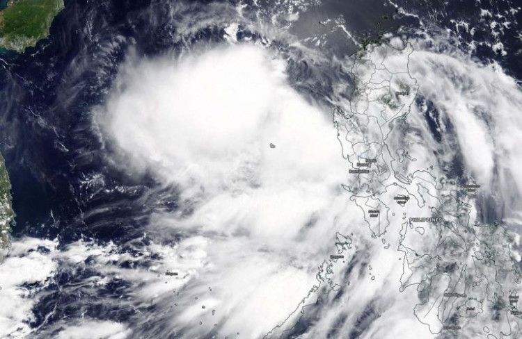
(Photo: NASA/Worldview)
Hong Kong Observatory has issued typhoon signal No 3 on Saturday as Tropical Cyclone Nuri will be closest to Hong Kong in the small hours on 14 June, skirting around 200 kilometers to our southwest.
The Observatory said that Tropical Storm Nuri was estimated to be about 200 kilometers south-southwest of Hong Kong (near 20.6 degrees north 113.6 degrees east) at 11 p.m. (Local time) and is forecast to move northwest at about 22 kilometres per hour towards the coast of western Guangdong.
"Local winds are generally strong and occasional gales are affecting high ground. The Strong Wind Signal, No. 3 will remain in force for some time." The Observatory also warned.
Earlier, The HKO said the Standby Signal, No. 1 is in force, which means that a tropical cyclone now centered within about 800 kilometers of Hong Kong may affect the local residents.
"At 1 p.m., Tropical Storm Nuri was estimated to be about 360 kilometres south-southeast of Hong Kong (near 19.2 degrees north 115.3 degrees east) and is forecast to move northwest at about 22 kilometers per hour crossing the northern part of the South China Sea, edging closer to the coast of western Guangdong." The Observatory said in the warning bulletin.

Tropical Cyclone Nuri approaching Hong Kong, HKO Issues Warning
The Observatory said earlier it will issue the Strong Wind Signal, No. 3 between 2 p.m. and 4 p.m.(HK local time), "The outer rainbands of Nuri are affecting the coast of Guangdong. There are also swells. Members of the public are advised to stay away from the shoreline and not to engage in water sports."
According to NASA, Tropical Depression Nuri formed by 5 p.m. on June 12 (HK local time) after passing over Luzon, Philippines and moved into the South China Sea.
Check the live tropical cyclone track information on HERE.